Episodes Irish Revolution Season 2 — The Civil War
Drawing the Border
Transcript
Welcome to the History of Ireland. Hello, hello, hello. Did you miss me? I am so sorry for my prolonged absence. I think this is the only really long break I’ve taken since starting the podcast about four years ago. I do apologise for disappearing for so long and without warning. I had planned to take a break over Christmas to spend time with family and recharge. And that break stretched out all the way to mid-March. Oops.
A bit of that is down to needing longer to recharge, flying back across the world and the joys of house hunting in Melbourne. But it’s also down to a few fun projects that I’ve been working on that are not quite ready to see the light of day just yet. Thank you so much to everyone who got in touch to check in and see if everything was OK. I really do appreciate it. You are just the best. And I love hearing from all the listeners. Thank you for listening and thank you for bearing with me while I bounce around the world and take a little bit of a break. Now I’m ready to get stuck back into it and we’ll be going back into our rhythm of fortnightly episodes.
OK, so where were we? We had been discussing the Army Emergency Powers Resolution brought in by the Cosgrave government in September of 1922. We had touched on the early implications of that. But before we explore the end of 1922, I want to rewind slightly and look at what was happening in Northern Ireland throughout that tumultuous year. As we know, the division between Northern Ireland and the South of Ireland was created by the Government of Ireland Act of 1920. The Northern Irish Parliament was then opened in 1921 by George V and it was led by James Craig. But when the Irish Anglo Treaty came into effect, the Irish Free State was created and the Northern Irish border became an international one.
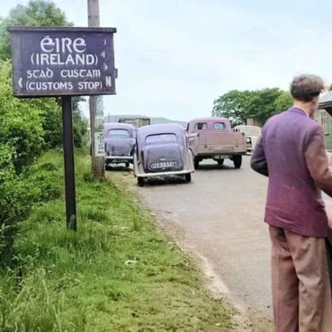
As we all know too well, a border on the island of Ireland can be a very difficult thing. As the Civil War kicked off in the South, the North descended into its own form of chaos. Between the period of June 1920 and July 1922, nearly 500 people were killed, with 230 of those deaths occurring between February and May 1922. This is some grim and depressing stuff. But before we explore that chaos, I want to pause and spend a little bit of time answering the question of how the border of Northern Ireland was actually created. Yes, the actual physical border. How did they decide it? This is something I’ve wanted to discuss since way back when the podcast started, but I’ve never managed to find a spot to fit it in. Until now. So buckle in as we dive into the exciting world of representation, administrative units and the complicated job of drawing lines across maps.
So the Government of Ireland Act stated that Northern Ireland shall consist of the parliamentary counties of Antrim and Man, down from Manor, Londonderry and Tyrone, and the parliamentary boroughs of Belfast and Londonderry. And Southern Ireland shall consist of so much of Ireland as is not comprised within the said parliamentary counties and boroughs. Did you get that? From Manor, Antrim, Tyrone, Derry, Armagh, down. Or as we learned in school, Fat Dad. But how did they land on this decision? Why not include all nine counties of Ulster? Why include Catholic majority from Manor and Tyrone? Why, why, why, why, why, why, why?
To understand the Northern Irish border we actually have to go all the way back to 1914. And I know a few medievalists who would laugh and say that’s not nearly far enough, but it’ll do us for today. Less than a decade before the founding of the Irish Free State the politics of the time were so different that 1914 may as well have been part of a different century. Pre-World War I, pre-1916 Rising, pre-War of Independence. The leaders of the Irish movement were still the likes of John Redmond, John Dillon and Joseph Devlin. No one had heard of Michael Collins or De Valera and Arthur Griffith was seen as a bit of a nut. And oh yeah, Home Rule was all the rage. But the Ulster Unionists were having none of it.
If Ireland was to have Home Rule Unionists wanted Ulster to sit separately. We know this. And so the British government under the then Prime Minister Asquith asked Redmond and Co for quote secret approval for a strictly time-limited exclusion of an undetermined portion of Ulster from Home Rule. Now the Irish leaders agreed to that. It sounded pretty good. Strictly time-limited and an undetermined portion. So the next job was to decide which parts of Ulster were included in Home Rule and which were excluded. How would you think to do this? A referendum? A vote in Parliament? A citizens assembly? Nope, the British didn’t do any of that. Instead, three senior Irish civil servants were asked each to draw up their version of quote a boundary for an Ulster exclusion zone. The three men chosen were Sir James B. Doherty W. F. Bailey and Sir Henry August Robinson. Each man had a different approach and it’s kind of fascinating to see how they split the country.
Bailey’s was the simplest method. It followed the Donegal boundary, cut a line straight through Romana and divided Monaghan in two. Bailey focused more on a physical geography to define the border. Maybe he was a little more forward thinking and saw that this might become more of a permanent split than everyone was letting on. But this reliance on geography and a disregard for population or the realities of administration in the area made his map a little bit of a tough sell for the bureaucrats.
Next, you had Robinson’s approach. Now Robinson, he got down in the weeds looking at local government boundaries as he described it, his quote operational unit. Robinson was the only one who considered roads and rail connections and he was a lot more sympathetic to the Catholics. Rather than relying on topography or counties, Robinson looked at population. Carving counties in half to match the divisions of Catholic v Protestants. For example, on Robinson’s map, South Armagh and South Down stayed part of the southern state as they were heavily Catholic. As well as this, as he put it, he factored in, quote, the degrees of obstreperousness in the rival sectarian factions on the borderline. Yeah, look, I had to Google that word. That’s how people who devise borders speak. Basically what he means was he considered how difficult it would be to manage people who consider themselves stuck on the wrong side of the line.
For example, he included an area as part of the southern state in Fermanagh simply because he feared violence. As he put it, there has been more money spent on armament and drilling here than in any part of the country and these Enniskillen and Lissanaski Protestant farmers are the most bloodthirsty set of ruffians I know. Robinson was dubious of the whole situation, stating, I expect you will find that the Ulsterman’s minimum will be six entire counties in and no option. Personally, I agree about putting the matter to a plebiscite. It will indeed mean riots when this crucial issue is announced.
Finally, you had Doherty’s approach. Doherty did not seem to relish the task ahead of him, writing that it would be a difficult if not impossible job to construct these pens and that the policy of exclusion, whatever plan may be adopted, bristles with difficulties and I do not see how they are to be surmounted. Doherty considered a bunch of options but decided to go with the simplest and divide the area by county. Unlike Robinson, he didn’t really consider the violence nor was he shaped by geography like Bailey. Doherty, the good civil servant that he was, was swayed by, quote, the administrative headache he foresaw in dealing with an otherwise excluded area in which local government boards, county councils and existing parliamentary constituencies would be split across two jurisdictions. Doherty seemed to lean towards a four-county option but ended up suggesting the six-county separation because, as he said, it is difficult to see how the Ulster Covenanters, the unionists, in the four included counties can abandon their brethren in Tyrone or Fermanagh.
All three of the mapmakers argued that the Catholic Church would be the best choice All three of the mapmakers argued that the Catholic majority city of Derry or Londonderry should be excluded but all three were also ignored. The three maps were shown to both unionists and nationalists and in the end Doherty’s six-county version was chosen. But as historian Conor Mulvig puts it, the stark reality of the Irish border is that it was never intended to be an international boundary. These maps you see were taken to a conference held in Buckingham Palace on July 1914 and as you can imagine things were fairly tense and it took a long time for anyone to agree on anything. Prime Minister Asquith summarized the meeting as such We sat again this morning for an hour and a half discussing maps and figures and always getting back to that most damnable creation of the perverted ingenuity of man the county of Tyrone.
The extraordinary feature of the discussion was the complete agreement in principle of Redmond and Carson each said I must have the whole of Tyrone or die but I quite understand why you say the same. I for one would like to apologize to the lovely people of Tyrone but you can see why Asquith was annoyed. Why should both Tyrone and Fermanagh both with Catholic majorities though only small ones, be part of Northern Ireland? That was Redmond’s argument he thought they should be Southern Ireland but Carson wasn’t going to abandon a single unionist on the wrong side of the line and it should be pointed out that the unionists themselves they actually didn’t want all nine counties of Ulster they knew that taking Donegal, Cavan and Monaghan would mean more Catholics in the Northern Irish state which would dilute their power but on the other hand only taking four counties that would make the whole state unviable so they needed Tyrone and Fermanagh then as they were arguing through all of this a much much much bigger argument kicked off yep, World War I interrupted these debates and everything was put on hold until after the war except as we know it’s very hard to put questions of national identity on hold and the 1916 Rising, the War of Independence and now in 1922 the Treaty all pull the question of what a border should look like very much to the forefront of everyone’s mind
so it’s important to remember that the border as it sat at six counties was a fairly loose thing something that had been half agreed upon in 1914 in a completely different political climate and though it had been considered relatively loose in 1914 the 1920 Government of Ireland Act well it entrenched the idea of a six-county Northern Ireland based on Doherty’s more administratively led border and it was this partition that was further cemented by the Anglo-Irish Treaty this is where Griffith and Collins’ trust in the idea of a boundary commission starts to make sense yeah, we’ll give the Unionists the six counties but it won’t be permanent and surely any boundary commission worth its salt will be forced to hand over for Manor and Tyrone again though we see the dangers of kicking these problems down the road and much like the 1916 Rising the Civil War changed the political landscape all over again as we know neither Griffith nor Collins lived long enough to oversee their precious boundary commission and anyone who knows anything about Northern Ireland knows that that boundary commission really didn’t do much to stabilize the region or change the border but we’ll get to that
so there you have it a very quick rundown of how the Northern Irish border came to be the way it is next episode we’ll look at the ramifications of these decisions the impact of the treaty and the conflict that occurred throughout Northern Ireland in 1922 and I promise this time I won’t leave you hanging
thanks for listening subscribe wherever you get your podcasts and if you’re enjoying it give us a review on Apple Podcasts or tell your friends it really helps if you want to go further you can support the show get ad free listening and bonus content on our Patreon page simply follow the Patreon link in the show notes or visit our website thehistoryofireland.com you can also get in touch through the website or on Facebook and Twitter it’s always great hearing from you guys and if I’ve made a mistake please do let me know
The History of Ireland was written and produced by me, Kevin Doyle with music by Liam Doyle and additional help from assistant producer Aoife Murphy This podcast was recorded in the lands of the Wurundjeri people of the Kulin Nation Sovereignty was never ceded